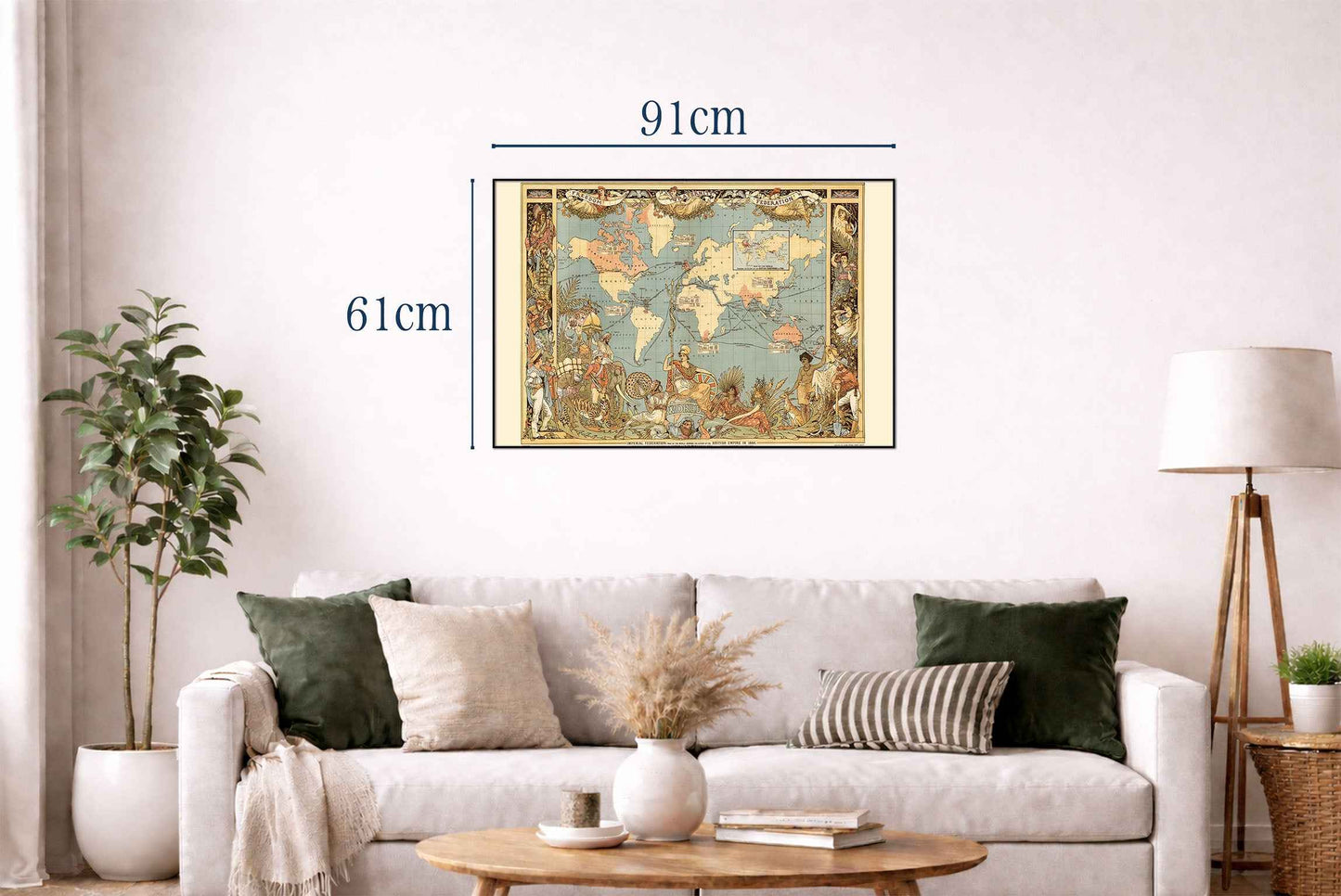
Explore one of the most iconic maps of the Victorian era with this remarkable British Empire World Map Poster, titled "Imperial Federation – Map of the World Showing the Extent of the British Empire in 1886." Created by John Charles Ready Colomb and beautifully illustrated by Walter Crane, this extraordinary pictorial map was published in 1886 as a supplement to The Graphic and presents a fascinating visual record of the British Empire at its greatest territorial extent.
Using a Mercator projection centered on Greenwich, the map highlights British possessions in red, dramatically illustrating why Britain was known as "the empire on which the sun never sets." Surrounding the map are elaborate allegorical illustrations by Walter Crane, including the iconic figure of Britannia seated above the globe alongside symbolic representations of Britain's colonies, featuring elephants, tigers, kangaroos, sheep, and figures in traditional dress from across the Empire.
Beyond its decorative appeal, the map includes detailed statistical information for major colonies, listing population, territory, and trade data, while an inset map compares the British Empire in 1786 with its enormous expansion by 1886. The banner reading "Freedom, Fraternity, Federation" reflects the imperial ideals promoted during the Victorian period, making this work both an important historical document and a fascinating example of political visual culture.
Rich in symbolism, historical detail, and exceptional Victorian artistry, this vintage world map poster is perfect for historians, collectors, educators, political history enthusiasts, and admirers of antique cartography. It makes an impressive wall decoration for libraries, offices, studies, classrooms, or interiors inspired by world history and the Age of Empire.
This is a reproduction print of a historical map