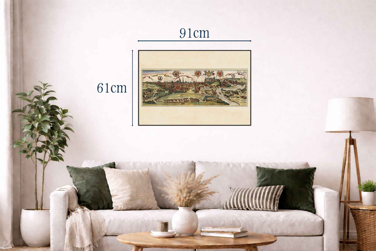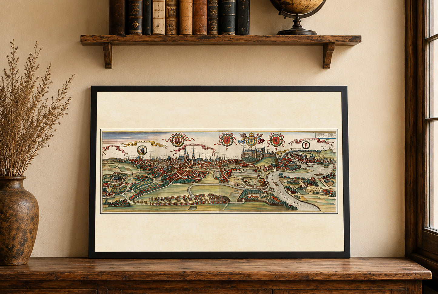


The image is a historical city view titled "Cracovia Metropolis" depicting Krakow, Poland, from the renowned atlas "Civitates Orbis Terrarum." Created by Georg Braun and Franz Hogenberg, this work was published in 1618. The atlas was an ambitious project, aiming to provide detailed representations of world cities in the late 16th and early 17th centuries.
he engraving presents a bird’s-eye view of Krakow, showcasing the city’s layout, architecture, and surrounding landscape. The medium used is a detailed engraving, typical of the period, which allows for intricate depiction of architectural and topographical elements. The city is portrayed with precision, highlighting major buildings, streets, and natural features, reflecting the atlas's aim to serve as both an informative guide and a decorative piece.
This is a reproduction print of a historical map