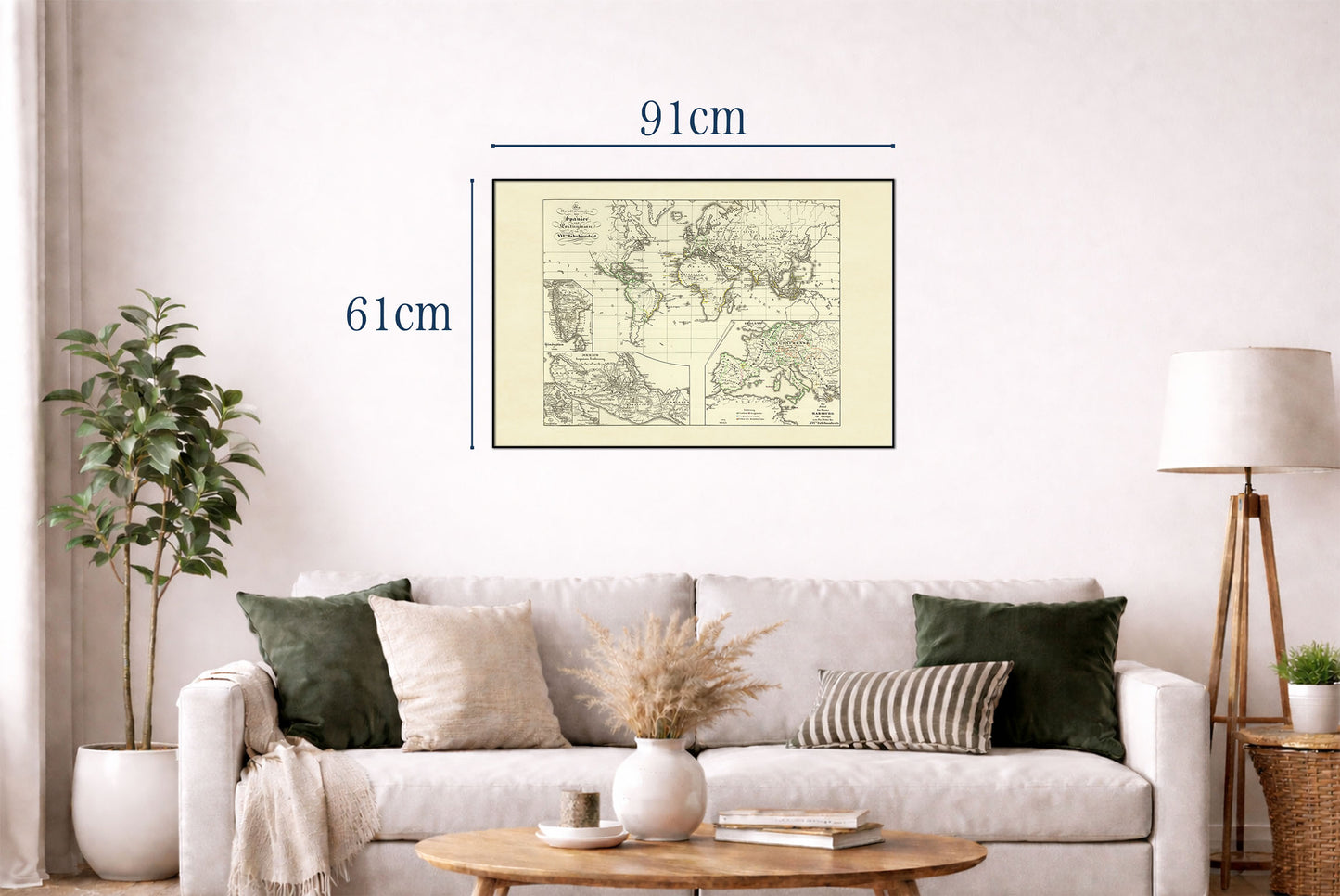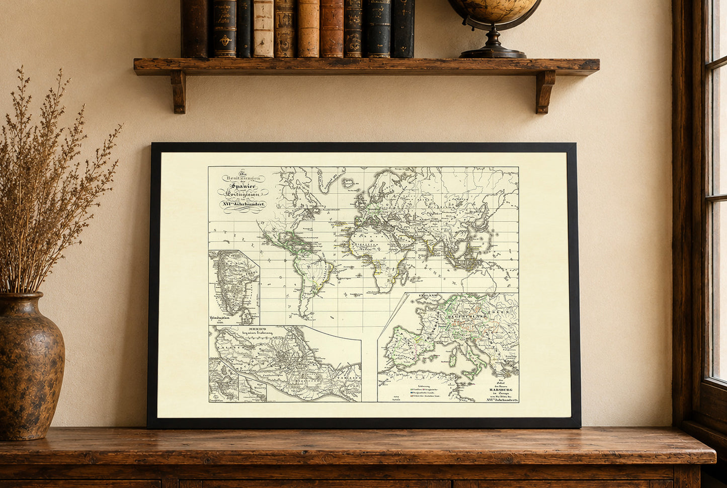


The image presents a historical map titled "Die Besitzungen der Spanier und Portugiesen im XVIten. Jahrhundert," created by Karl Spruner von Merz in 1854. This map is part of "K.v. Spruner's histor. Atlas: Spanien u. Portugal No. VI," published by Justus Perthes. The map's dimensions are 41 cm in width and 32 cm in height, and it is a hand-colored depiction of the colonial possessions of Spain and Portugal during the 16th century. Relief is shown by hachures, a method of shading used to indicate elevation on maps.
The map employs a traditional 19th-century cartographic style, with meticulous engraving by C. Stier. It is hand-colored, which was a common technique of the time to distinguish different territories and features. The map is a part of an atlas that includes various other maps providing historical and geographical insights.
This is a reproduction print of a historical map