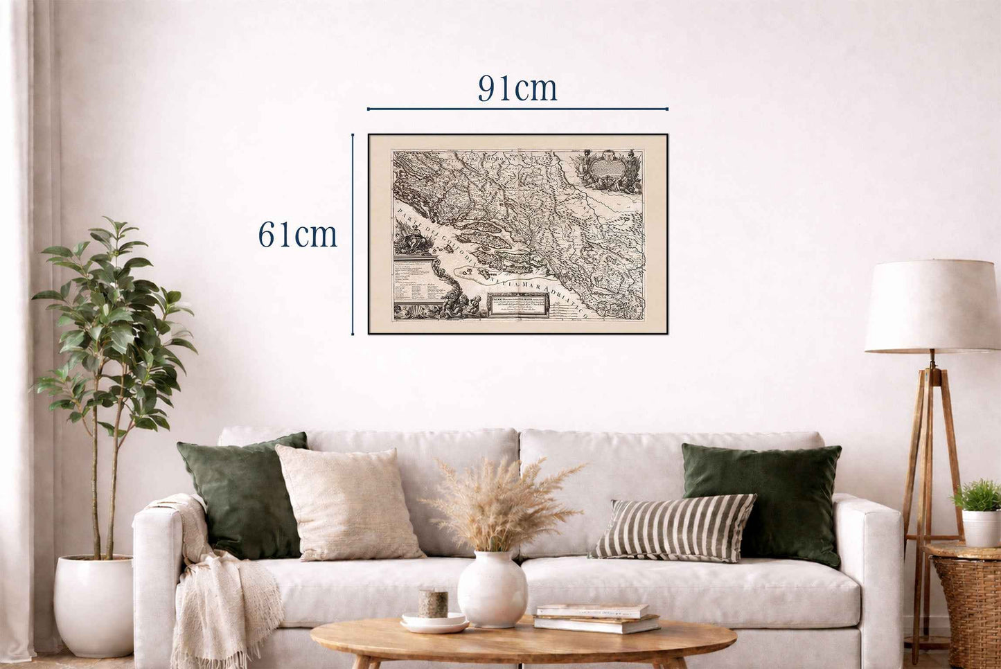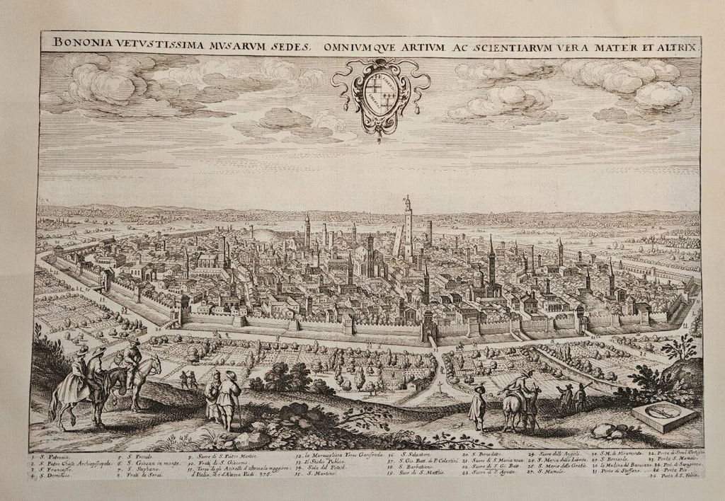


Discover the beauty of Baroque-era cartography with this exceptional Dalmatia Coast Map Poster titled “Dalmatia maritima Occidentale e Dalmatia maritima Orientale,” created by Giacomo Cantelli and published by Giovanni Giacomo de Rossi in Rome in 1689. This richly detailed historical map presents the Adriatic coastline of Dalmatia, covering regions that are now part of modern-day Croatia and Slovenia.
Created as part of the renowned atlas “Mercurio geografico overo Guida geografica in tutte le parti del mondo,” the map exemplifies the refined elegance of late 17th-century Italian cartography. Bold engraved linework, delicate hand coloring, and elaborate Baroque ornamentation combine to create a visually striking composition that blends scientific geography with decorative artistry.
The map carefully illustrates the western and eastern Dalmatian coastline along the Adriatic Sea, featuring mountains, rivers, valleys, islands, coastal settlements, churches, cities, and administrative regions. Relief is depicted pictorially, providing depth and texture to the rugged coastal landscape. Decorative cartouches and ornamental details reflect the grandeur and sophistication of Baroque artistic traditions.
One of the map’s most fascinating features is its inclusion of both ancient and contemporary place names, offering valuable insight into the region’s complex historical and cultural evolution. The composition captures the strategic importance of the Adriatic coast during a period of intense maritime trade and political rivalry in Europe.
Perfect for collectors, historians, travelers, and admirers of antique European maps, this vintage Dalmatia poster adds timeless sophistication and historical character to offices, libraries, studies, living rooms, and coastal-inspired interiors.
This is a reproduction print of a historical map